
Huella Andina stages, recommended starting points, bus connections
Part one: From Villa Pehuenia to Alumine, 7 stages, 5-7 days of walking
How to arrive: There’s a regular bus service from Neuquen airport (daily flights from Buenos Aires) to Villa Pehuenia. The bus passes through the city of Zapala, where you’ll find another, small airport. From Lago Rucachoroy (one of two possible ending point of this part of Huella Andina) there’s a bus service to Alumine, and from there a bus service to Junín de Los Andes, from where you can take the bus to the next part of Huella Andina.
Specifications of this part:
- First three stages aren’t marked yet and you’ll need to walk on the dirt road, or hitchhike. The waymarked trail start from Norquinco, stage 4 . of Huella Andina.
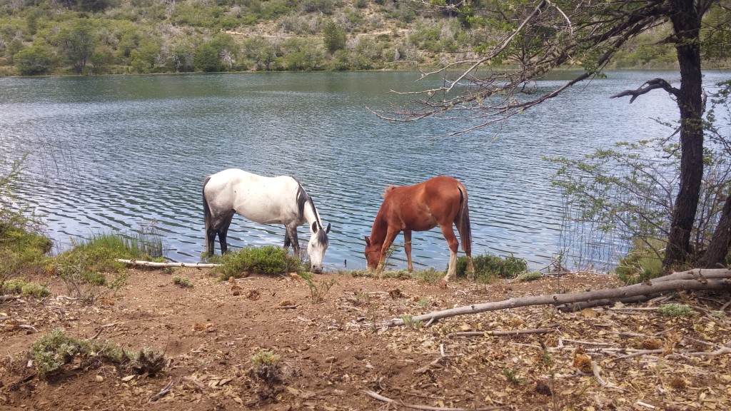
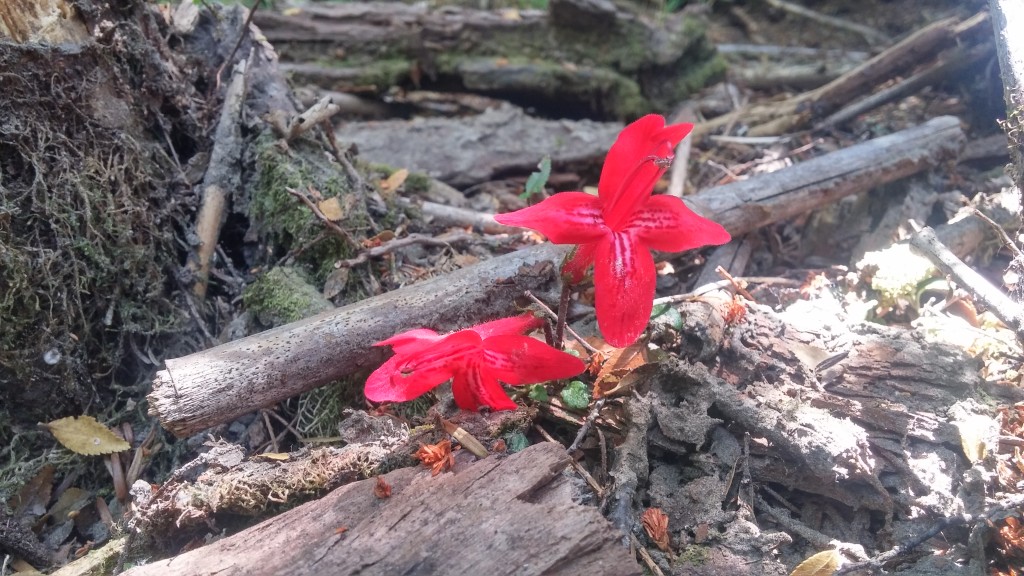
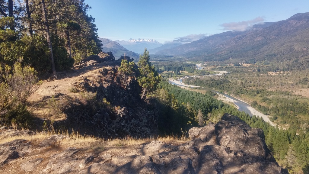
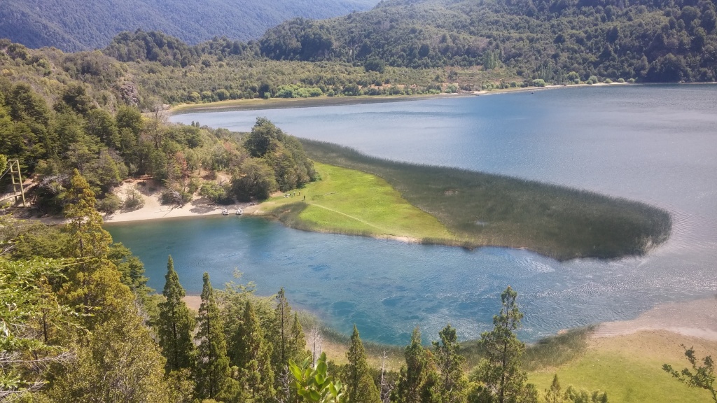
- You’ll enjoy amazing lakes and virgin nature, meeting minimum hikers (or no hikers) on the trails. Camping places are run solely by Indians from Mapuche tribe, and they are located next to magnificent lakes like Lago Aluminé, Norquinco, Rucachoroy, Quillén. Some of them do not offer hot water and some of them won’t be that clean, but they have a nice atmosphere.
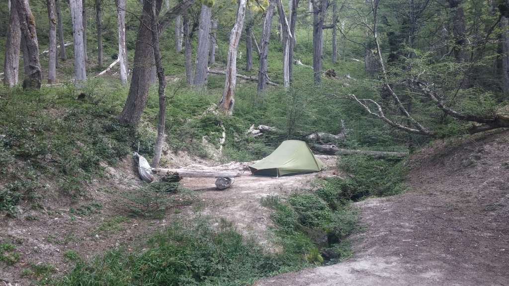
- You’ll sleep in two mountain bivouacs, close to 2,000 above see level.
- Little infrastructure and untouched mountains offer a unique experience that can’t be easily matched anywhere else.
- Big green parrots and other birds live next to the lakes and rivers on this way.
Facilities:
- Wifi: Villa Pehuenia, Lago Rucachoroy, Aluminé
- Grocery stores: Villa Pehuenia, Moquehue, Norquinco, Rucachoroy, Aluminé
- Recommended places to sleep: Eco camping in Norquinco, Rafting Alumine (hostel). In other locations it doesn’t matter much.
Stages
Stage; Difficulty ; Duration (hours ; Distance (km) ; Notes
1.Villa Pehuenia – Moquehue; medium difficulty, 6hours; 14.50km; The stage isn’t waymarked at the moment. There’s an alternative way which follows a dirt road that connects Villa Pehuenia and Moquehue, 18 kilometers of walking. The alternative way isn’t waymarked either, but since you follow a road (with minimum traffic), you can’t get lost.
2. Moquehue – Vivac Puesto Viejo; high difficulty, 6 hours, 12.5km; This stage isn’t marked at the moment, and you can’t follow it. If you want to walk in the direction of the way, you’ll need to follow a dirt road which connects Lago Moquehue with Lago Ñorquinco, 35 km on a dirt road. Possibility to hitchhike.
3. Puesto Viejo – Ñorquinco; low difficulty, 4 hours, 12km; Not waymarked at the moment, see stage 2. for instructions on how to get to the start of waymarked trail.
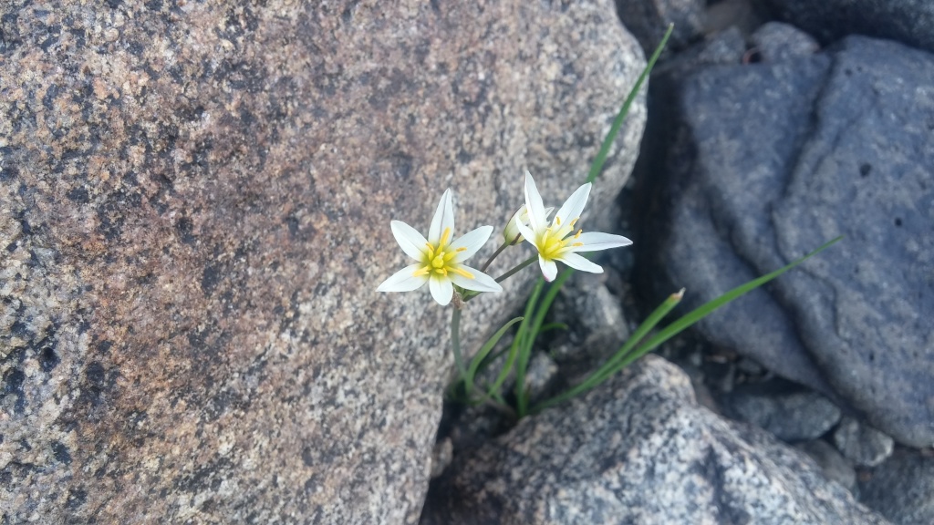
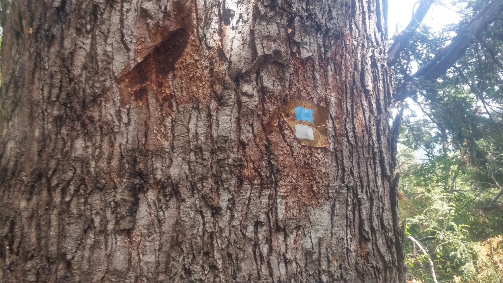
4. Ñorquinco – Vivac Pampa de Castro; medium difficulty; 6 hours, 15km; Obligatory registration, good way-marking, green way full of life, parrots, and beautiful flowers. Sleeping in a bivouac, drinkable water nearby.
5. Vivac Pampa de Castro – Lago Rucachoroy; medium difficulty, 5 hours, 18km; The way goes down to the valley where it follows an open space, without any shades or shelters from the sun, which makes it more difficult as it seems on the map. I recommend starting early, the avoid the afternoon heat. There are several campings next to Lago Rucachoroy, and despensa (shop with more varied supplies) is located three more kilometers from the camping.
6. Lago Rucachoroy – Vivac Malalco Chico; medium difficulty, 6 hours, 12 km; You go up all the time, little shelter from the sun. There’s a big tent in a Vivac Malaco Chico for hikers, so if you decide to come back to Rucachoroy from the Vivac, you can walk here without a tent. Good way-marking.
7. Vivac Malalco Chico – Lago Quillén; high difficulty, 4,5 hours, 10 km; There’s no bus connection from Lago Quillén to Junín de los Andes, the place where you’ll need to go to continue the way. You can hitchhike to Aluminé from Lago Quillén, but the traffic is extremely low, since this virgin valley doesn’t attract many local visitors. If you decide to walk this stage, you should prepare yourself for the possibility of returning back to Lago Rucachoroy, from where you can get a regular bus to Aluminé (every Monday and Wednesday morning), or catch a ride there easily.
Part two, from Puerto Canoa to San Martin de los Andes, 9 stages, 7-9 days of walking
How to arrive: There’s a regular bus service from San Martín (that passes through Junín de Los Andes) to Puerto Canoa. San Martín is a popular travel destination and you’ll find a bus connection from either S. Carlos de Bariloche (airport, regular daily flights from Buenos Aires), or from Alumine (where you’ll arrive at the end of the first part of Huella Andina). The circle ends back in San Martín, so you can start and end in the same city.
Specifications of this part:
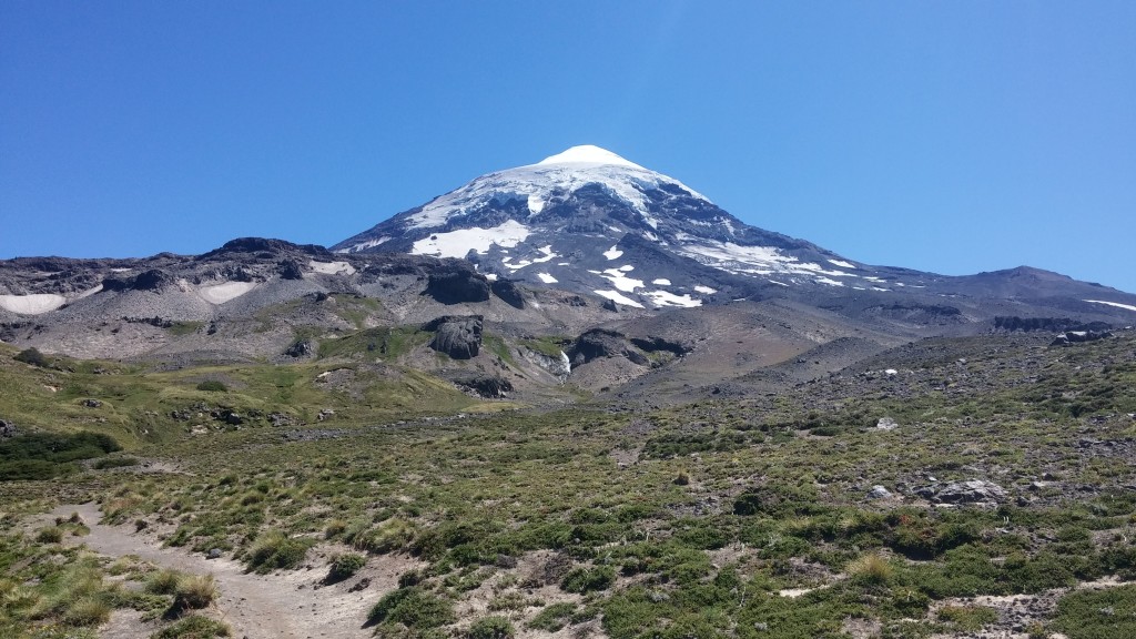
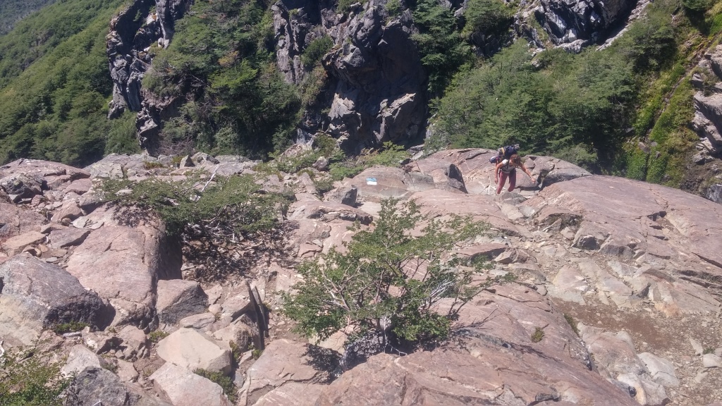
- Volcán Lanín, an amazing dominant of the national park that bares the same name.
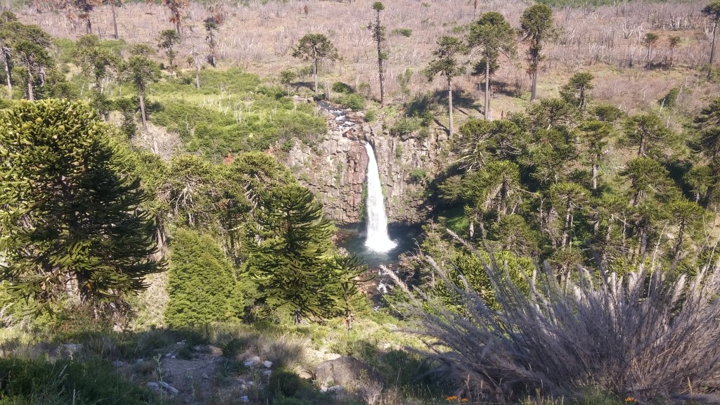
 Long stretches without civilization, sleeping in mountain shelters, dense vegetation and some tough hikes, especially from Laguna Verde to Puerto Arturo. Amazing nature with a lot of variety.
- Hot thermal springs on the way (in Termas de Epulafquen), you can relax in natural thermal pools with water temperature ranging from 30 to 40 degrees Celsius.
- Beautiful green city of San Martín, witch offers all the facilities.
- Combination of mountain shelters, hostels, and camping places.
- The circle can be walked in 7 days, connecting stages 9 and 10, and stages 13 and 14.
Facilities:
- Wifi: San Martín, Laguna Rosales (long stretch without connection)
- Grocery stores: San Martin, Puerto Canoa, Termas, Laguna Verde, Puerto Arturo, Laguna Rosales
- Recommended places to sleep: Refugio in Rincon de los Pinos, Camping in Puerto Arturo, Hotel Rosales (near Laguna Rosales), hostel Gleb (in San Martín).
Stages
Stage; Difficulty ; Duration (hours ; Distance (km) ; Notes
8. Puerto Canoa – Cara Sur del Volcán Lanín; medium difficulty, 8 hours, 20km (both up and down combined); You can leave most of your things in tourist office at Puerto Canoa, and walk with a light backpack, since you can not sleep at the base of the volcano, and have to come back to the place where you started your ascend. You need to start walking until 11am, otherwise they won’t let you go up. When coming back down to Puerto Canoa, you’ll need walking five extra kilometers to find the first organized camping place with food supplies.
9. Puerto Canoa – Aila; low difficulty; 3 hours, 9 kilometers; You need to cross the lake at a narrow spot, with the help of the boatman. The crossing point is poorly marked, look for the boats on the other side of water to find it. Ring the bell and the boatman will come to take you “to the other side”. The one minute boat ride cost me 50 pesos. The boatman will show you the beginning of the marked trail that leads to Aila.
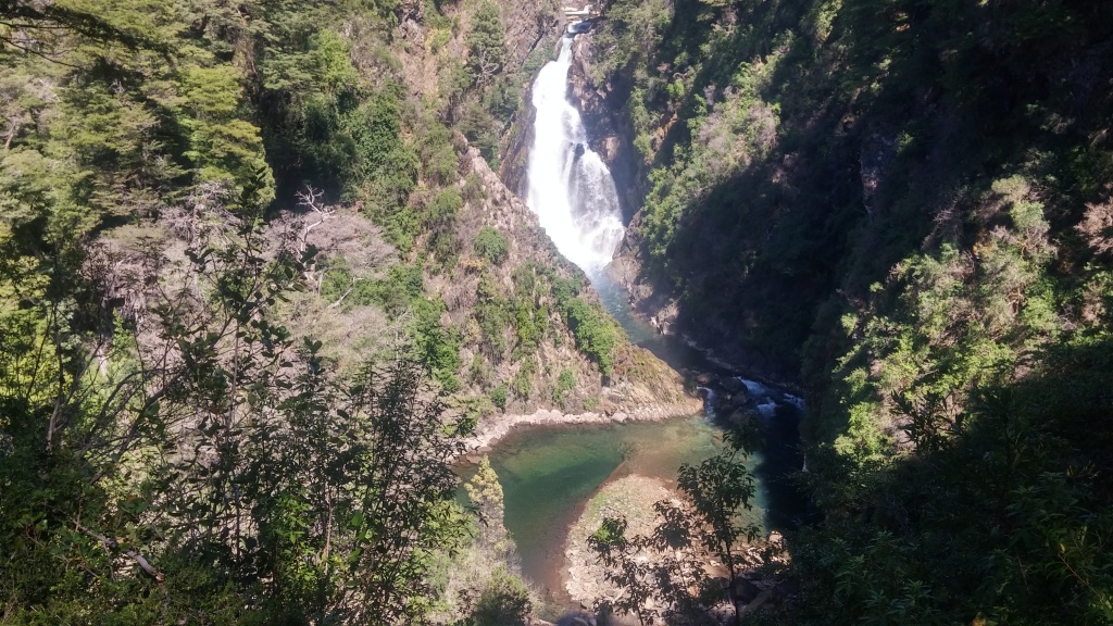
10. Aila – Termas de Epulafquen; medium/high difficulty; 8 hours, 18 kilometers; Thick vegetation makes the stage more difficult , waymarking could be better. Expect a few river crossings on your way. You can possibly connect stages nine and ten together and walk from Puerto Camoa to Termas in one day. Small natural thermal pools (free to enter, ten minutes walk from the camping) will help you with your regeneration. Food supplies in the camping are very limited.
11. Termas de Epulaufquen – Laguna Verde; low difficulty; 5 hours, 14 km; Road walking, a connecting stage one cannot avoid. Very limited food supplies in the camping, but you can walk one kilometer and buy more food, which you will need for the next few stages, since there’s no option to buy anything. People from the camping will show you the way to the shop.
12. Laguna Verde – Rincón de Los Pinos; high difficulty; 7 hours, 16km; Difficult way, amazing landscapes, river crossings, variety. Thick vegetation and fallen trees make the way more difficult. You’ll sleep in a shelter hut deep in the mountains, where you’ll find a fireplace and drinkable water. No food supplies along the way.
13. Rincón de Los Pinos – Auquinco; medium difficulty; 4 hours, 12km; Thick vegetation in the first few kilometers, river crossings, shelter hut next to the river Auquinco. No food supplies along the way. You can possibly connect stages 13. and 14., walking all the way from Rincón to Puerto Arturo, where you’ll find a beautiful camping with food supplies and all facilities.
14. Auquinco – Puerto Arturo; medium difficulty; 6 hours, 13km; Many small uphills and downhills, otherwise a relatively easy way. Good camping with restaurant and food supplies in Puerto Arturo.
15. Puerto Arturo – Laguna Rosales; low difficulty, 4 hours, 15km; Connecting stage, you will walk on a road with quite a lot of traffic. I recommend hitchhiking from El Lolog to Laguna Rosales, where you’ll find a nice hostel for hikers, called Hostel Rosales.
16. Laguna Rosales – San Martin de Los Andes; low difficulty; 4 hours, 14km; Easy stage full of flowers and meadows, you’ll walk close to the military area, be careful and stick to the waymarked path. In San Martin you’ll find hotels, hostels, restaurants, all kind of shops to refill your supplies and get a new gear if needed.
Part three, from Quila Quina to Hua Hum, 3 stages, 3-4 days of walking
How to arrive: There’s a regular daily bus to Hua Hum from San Martin. However, if you decide to walk from Quilla Quina, you’ll need to hitchhike there, or rent a texi in San Martin. Ask in a local tourist for an advice on getting there. You begin and end your walk in San Martín, where you can easily get by bus from Bariloche (which has regular airport connection with Buenos Aires).
Specifications of this part:
- Famous beach of Quilla Quina, where you’ll meet many locals and also some foreigners.
- A short way that can be walked without a tent (you can sleep inside in Puesto Casanova and in Quilla Quina, and you in a big permanent tent in Ruca Nire. So you’ll need just a sleeping bag.
- Ideal part for people with little hiking experience, who want to try walking on the Huella Andina.
Facilities:
- Wifi: Quilla Quina, San Martin
- Grocery stores: San Martin, Quilla Quina, Parana, Chachin
- Recommended places to sleep: Organized camping at Quilla Quina, Shelter in Puesto Casanova, big tent at Ruca Nire.
Stages
Stage; Difficulty ; Duration (hours ; Distance (km) ; Notes
17. Quila Quina – Puesto Casanova; low difficulty; 3 hours, 10km; Walking on a dirt road, refugio with blankets at the end of the walk. There’s no bus from San Martin to Quila Quina. You can either hitchhike, orwalk on the road – not an easy, 18km walk. For this reason, I recommend walking this part of Huella Andina in an opposite direction, starting from Hua Hum and ending at Quilla Quina beach. Several buses depart from San Martin to Hua Hum every day.
18. Puesto de Casanova – Ruca Ñire; medium difficulty, 7 hours, 16 km; Few strenuous climbs and downhills, a difficult walk for anyone without a good physical condition. You’ll find a big empty tent in Ruca Nire, where you can sleep for free, but you need to have your own sleeping bag with you. Private beach and campfire promises a nice evening under the stars… No food supplies along the way. Buy things at Quilla Quina or San Martín.
19. Ruca Ñire – Hua Hum; medium difficulty, 6 hours, 14 kilometers; you can spend a night in the camping in Hua Hum, or in Chachín, from where you can make a short, one kilometer walk to Cascada Chachín, which is definitely worth the effort. The way-marking could be better, watch out to not walk too far from the coast of the lakes. Many food supply options along the way.
Part four, from Villa Traful to Villa Angostura and Bosque de Arrayanes, 4 stages, 3-4 days of walking
How to arrive: There’s a regular bus service from San Martin to Villa Traful. Ask the driver to drop you at Camping Catarata if you want to skip the boring stage from Villa Traful to camping Catarata, which goes on the road full of cars. You’ll end your walk in a beautiful tourist city of Villa Angostura, where you can do an additional walk to Bosque de Arrayanes and back. Angostura has good traffic connection with all major cities including San Carlos de Bariloche, where the next stages of Huella Andina start.
Specifications of this part:
- Many river and creek crossings on your way to Tapera de Lagos, a night in an amazing bivouac
 Necessity to walk on the road, or hitchhike, at the end of the waymarked trail, to get from Cerro Bayo to Villa Angostura.
- Two strange and not very interesting stages, from Villa Traful to camping Catarata and from Villa Angostura to Bosque de Arrayanes, however, you can skip both of them if you want, and enjoy just a beautiful crossing of the vivac Tapera de Lagos (2 days hike).
Facilities:
- Wifi: Villa Angostura only
- Grocery stores: Villa Traful, Camping Catarata, Villa Angostura
- Recommended places to sleep: Camping Catarata, vivac Tapera de Lagos, any hostel in Angostura.
Stages
Stage; Difficulty ; Duration (hours ; Distance (km) ; Notes
20. Villa Traful – Camping Catarata; low difficulty; 2.5 hours, 10km; Connecting stage, on the road, many cars. I recommend you to ask the bus driver (you’ll take a bus from San Martin to Villa Traful) to drop you right at Camping Catarata (it is along the way), and skip this stage. Vila Traful isn’t worth the visit, and walking on a dirt road full of cars is no fun.
21. Camping Catarata – Tapera de Lagos; high difficulty; 6 hours; 14 km; Beautiful stage full of little creeks you’ll have to cross. Extra shoes will come handy. No food supplies in Tapera de Lagos, but it has a fireplace and an amazing scenery.
22. Tapera de Lagos – Cerro Bayo; high difficulty; 7 hours; 12 km; there’s no camping in Cerro Bayo (it’s only a ski center). You’ll need to walk, or hitchhike, additional 12 km to reach Villa Angostura where you can sleep either in a camping or in a hostel.
23. Angostura – Bosque de Arrayanes; medium difficulty; 3 hours; 12 km; very easy walk without any connecting stage, included in the Huella Andina just for the purpose of promoting tourism in Villa Angostura. You can take a boat back from Bosque de Arrayanes to Angostura, a rather expensive one (30 euro for 45 minutes ride). You can also rent the bike to do this stage and give yourself a break from walking.
Part five, from San Carlos de Bariloche to Lago Puelo (Bolson), 9 stages, 8-9 days of walking
How to arrive: Bariloche has a daily flight connection with Buenos Aires. If you walk the entire way of Huella Andina, you can take a regular bus from Angostura to Bariloche (every few hours during the day). From Bariloche you’ll need to take a remis or taxi to Tambo de Baez, where the walk starts.
You will end up your walk in Lago Puelo, close to the famous city of Bolson, which has good connection with all major cities, including Bariloche. If you decide to continue walking the Huella Andina from Lago Puelo, you can continue walking straight from the lake.
Note: It was not possible to continue walking from Lago Puelo in 2016, since the forest fires destroyed the mountains and the stages of Huella Andina that start from Lago Puelo were closed. We hope that they will reopen them soon…
Specifications of this part
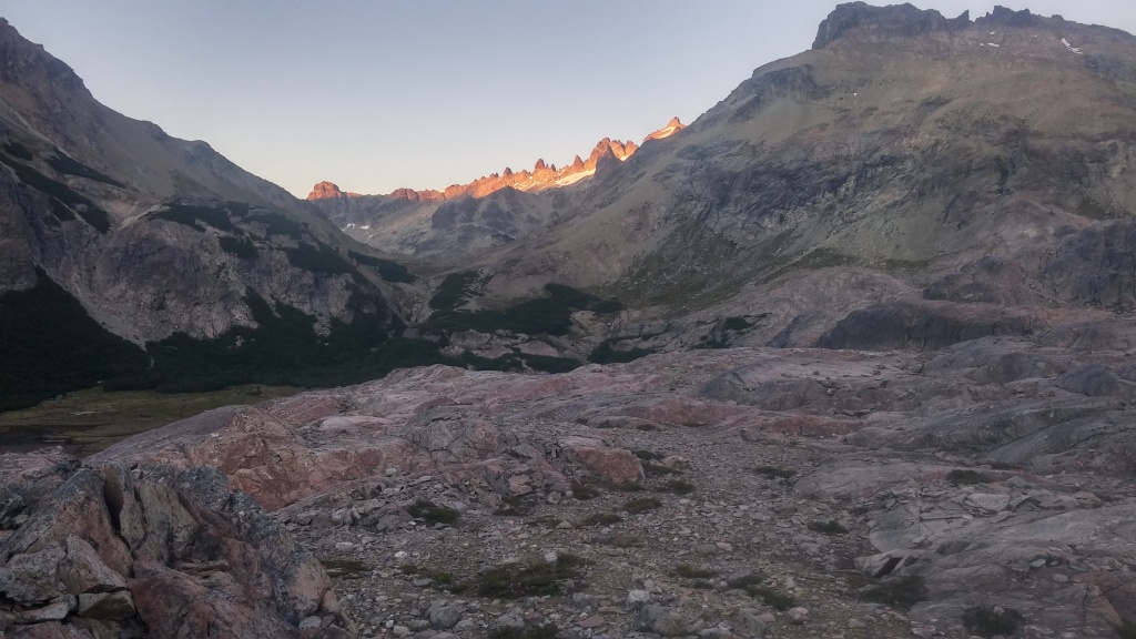
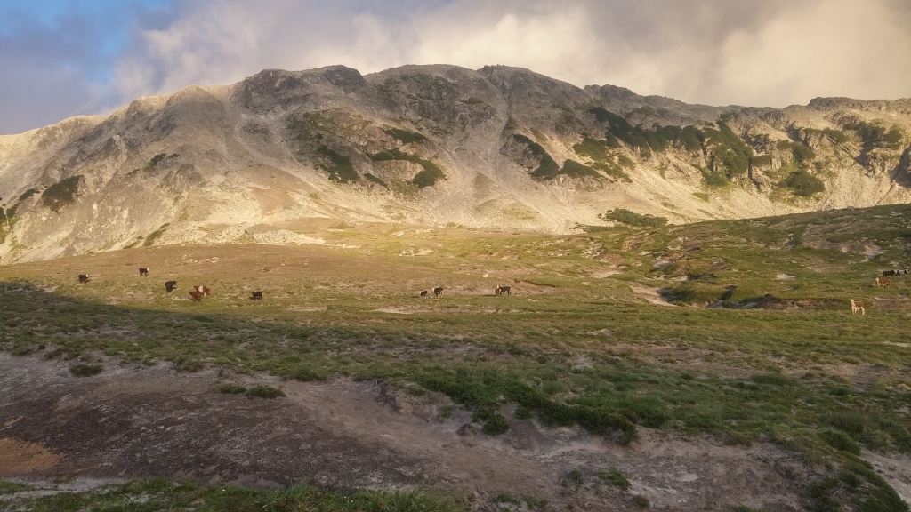
- Huella Andina offers you a great variety at this stage. You’ll walk on some popular trails (Laguna Jakob, Wharton), where you’ll meet many hikers and even some foreigners. On the other hand, trails to Los Césares, or the way from Lago Mascardi to Lago Stefen, are pretty deserted.
- Variety of landscapes awaits you as well, ranging from roads and easy forest walks to swamps and difficult rocky terrain high in the mountains.
- Beautiful lakes full of amazing water birds.
Facilities:
- Wifi: Bariloche, Hotel next to Los Césares, Villegas (you can connect to book shop wifi, there’s no password), Wharton, Bolson, Lago Puelo
- Grocery stores: Bariloche, Lago Mascardi, Lago Stefen, Villegas, camping Kaleuche, Wharton, camping Rio Azul, Lago Puelo.
- Recommended places to sleep: Refugio San Martín, camping Los Rápidos, Camping Lago Stefen, Charca Santa Lucia, Wharton.
Stages
Stage; Difficulty ; Duration (hours ; Distance (km) ; Notes
24. Tambo de Baez – Refugio San Martín (laguna Jakob); high difficulty; 6 hours, 14 km; There are no buses to Tambo, you can either take a taxi, or walk from the nearest bus station (consult tourist office in Bariloche). Sleeping in Refugio is quite expensive, however, you can eat there and sleep in your own tent next to the refugio. Beautiful location where you’ll meet many hikers and climbers.
25. Refugio San Martín (Laguna Jakob)- Los Césares; high difficulty, 10 hours, 20km; Rocky terrain, swamps and thick vegetation make this stage extremely tough. You’ll encounter countless small uphills and downhills along the way. When finally reaching Los Césares, you’ll have to walk a little bit more to find a hotel where you can eat. From there, it’s another 25 km to the start of the next stage, or 15 km to the nearest camping place with food supply (camping Los Rápidos). I strongly recommend to hitchhike either to Los Rápidos, or directly to camping at Lago Mascardi, where the next stage starts.
26. Lago Mascardi – Lago Steffen; high difficulty; 8 hours, 20 km; A long way with some small swamps to pass, Lago Steffen is very popular for locals who drive there by car and suntan on the beach. Decent food supplies in the camping.
27. Lago Steffen – Villegas; low difficulty; 4 hours, 11km; You can stay in camping in Villegas, however, you can continue to the start of the next stage, Camping Kaleuche. It’s a strenuous walk on a sunny road, 9 extra killometers, I recommend to hitchhike there. Good supplies along the way in both Villegas and Camping Kaleuche.
28. Camping Kaleuche – Chacra Santa Lucía; low difficulty; 5 hours 14km; Shelter in Charca Santa Lucia, no food supplies but they can make a dinner and breakfast for you. Interesting experience with staying in the farm in the mountains.
29. Chacra Santa Lucía – Perito Moreno; medium difficulty, 6 hours, 15km; You’ll need to cross Rio Foyel, which is impossible barefoot–prepare to get your shoes and body wet. If you walk in November or December the water level can be too high to cross on feet, and you’ll need to ask a ranger from Troncoso to help with a horse (he’ll happily do it). There’s a shelter at Perito Moreno, but do not expect to get any food there.
30. Perito Moreno – Wharton; low difficulty; 3 hours, 10km; Boring walk on the road, try to hitchhike if you can. Wharton is a good place to camp, you can hike from there to the mountain refugios near Bolson (not a part of Huella Andina). Ask for a map and recommendations in Wharton.
31. Wharton – Camping Río Azul; low difficulty; 5 hours, 16km; road walking, camping Río Azul offers some additional trails to mountain refugios.
32. Camping Río Azul – PN Lago Puelo; low difficulty, 5 hours, 15km; combination of some nice river-side walking, and some boring road walking.
Part six, from PN Lago Puelo to Portada Centro (Esquel), 8 stages, 7-8 days of walking
How to arrive: There’s a regular bus connection to Lago Puelo from El Bolson. You can reach Lago Puelo also by boat, from Chile. An evening minibus will take you from Portada Centro (end of the walk) to the city of Esquel, which has a flight connection with Buenos Aires, and bus connection with a locality close to Aldea Escolar, where the last two stages of Huella Andina start. If you want to start walking from Portada Norte (the first open stage at this section of huella Andina at the moment), take a regular bus from Lago Puelo to the city of Cholila, from where you can take micro that will drop you at Portada Norte.
Specifications of this part:
- Heavily affected by forest fires. Most stages are closed and you can not walk there at the moment.
- Beautiful old forests, some trees are more than 2,000 years old. Very peaceful and calm locations, with a minimum of tourists.
- Some high-quality camping places with good facilities.
Facilities:
- Wifi: Lago Puelo, Cholila, Hotel at Lago Verde (on the way), Esquel
- Grocery stores: Lago Puello, Cholila, Villa Lago Rivadavia, Camping Bahia Solis, Seccional Arrayanes, Villa Futalaufquen, Esquel.
- Recommended places to sleep: No specific recommendation for this part, since I walked only the open stages and all the camping places met good quality standards.
Stages
Stage; Difficulty ; Duration (hours ; Distance (km) ; Notes
33. PN Lago Puelo – El Desemboque; high difficulty; 7 hours, 13km; closed because of the recent forest fire, not possible to walk.
34. El Desemboque-Puerto Patriada; medium difficulty; 6 hours, 12km; closed because of the recent forest fire.
35. Villa Lago Rivadavia – Portada Norte; medium difficulty,6 hours, 11km; closed because of the recent forest fire.
36. Portada Norte – Camping Bahía Solís; medium difficulty, 4.5 hours, 10km; nice and simple to walk, watch the way-marking, many small roads can lead you out of the path.
37. Camping Bahía Solís – Seccional Arrayanes; medium difficulty, 8 hours, 16km; Scenic vista over Lago Verde, possibility to eat, well-equipped camping places. Way-marking could be better. Be sure to walk to the “Mirador Lago Verde”, one of the nicest viewpoints on the entire Huella Andina.
38. Seccional Arrayanes – Punta Mattos; medium difficulty; 6 hours, 13km; If the next stages are still closed due to forest fires, you’ll need to either hitchhike or wait and stop a minibus that goes to Esquel once a day, always in the evening. Ask in the camping for the information on the bus schedule.
39. Lago Krügger – Villa Futalaufquen; high difficulty; 12 hours, 20km; closed because of the recent forest fire.
40. Villa Futalaufquen – Portada Centro; low difficulty; 4 hours, 12km; closed because of the recent forest fire.
Part seven, from Aldea Escolar to Lago Baggilt, 2 stages, 3 days of walking
How to arrive: You can reach Aldea Escolar by bus from Esquel. Esquel has direct flight connection with Buenos Aires. From Lago Bagillt (the southernmost point of Huella Andina ) you need to descend back to Ruca Nehuen and return to the city of Esquel, from where you can either take a bis to all major cities on the Route 40, or fly back to Buenos Aires.
Specifications of this part:
- This section should interest you by one condition: that a trail to Lago Bagillt is open for hikers. In 2016 it was closed.
Facilities:
- Wifi: Aldea Escolar
- Grocery stores: Ruca Nehuen, Aldea Escolar (in the camping nearby)
- Recommended palces to sleep: bivouac at Lago Baggilt
41. Aldea Escolar – Ruca Nehuen; low difficulty; 3 hours, 12 km; serves more-less as a connecting stage for the hike to Lago Baggilt. If the stage to Lago Baggilt is closed, I do not recommend walking this stage.
42. Ruca Nehuen – Lago Baggilt; high difficulty; 6.5 hours, 16 km; closed, reason unknown.
Important Note: Before leaving to walk Huella Andina, or a part of the way, you should always check whether it is possible to walk the stages at the moment. The information were originally advertised on a governmental website of the track, which doesn’t exist anymore. Try to check this Facebook group for actual information. Or, opt for part 3, 4, 5, and 6 (see above) of the trail. The stages in these sections are the less affected by various incidents, and you can alsmost always walk them…
That’s it. Have you chosen the part of Huella Andina you’d like to walk? I hope you have! Now you may check my gallery from Huella Andina, or general information about the trail…
Buen viaje,
Matej